Moonraker VFX employed drone photography to create some of the most accurate mapping data and imagery ever produced for TV for Discovery Plus documentary, Valley of the Kings.
The company collaborated with Blink Films on the project which involved using pioneering drone footage to capture over 4sq kms of the Valley and its surrounding areas.
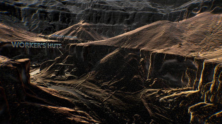
They filmed three gridded surveys of the West and one of the main Valleys, each made up of over 200 images, scaling the 400 metre depth and 500 metre distance between the two. The images were then used to create continuous shots for the viewer to understand the scale and intricacies of the site.
Simon Clarke, creative director of Moonraker said, “By having free reign to capture footage as high as a kilometre, to as low as few feet, the end result was a 3D photoreal model of the whole site, and allowed us to capture and create a seamless journey between valleys and tombs.
“This project has allowed us to push our boundaries as a studio, in terms of area captured and to advance the type of photogrammetry used in TV, a trend we expect to continue.”